Why GPS Matters: Understanding the Types, Benefits and Challenges
Imagine a world without accurate timekeeping. Our society would be thrown into chaos! From scheduling appointments to coordinating global communication, accurate timekeeping is the bedrock of modern society. It’s particularly crucial for navigation, where precise timing is essential for determining location. For attaining this accuracy, GPS system is used.
GPS System and History of GPS
What is GPS System?
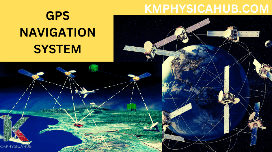
GPS stands for Global Positioning System and it is a precise satellite-based navigation system used to locate devices or individuals virtually anywhere across the globe.
History of GPS System:
GPS is a fascinating invention and the technological impact behind it is complemented well by developments and achievements made in the military field. The beginning of it started back in the 1960’s when the United States Department of Defense began the search for an accurate navigation system for their military personnel. The first experimental satellite known as Transit was launched in 1960 creating eventual formation of the full-fledged GPS system. The GPS was first launched in 1978; the network is today fully functional and was completed in 1995.
Importance of GPS in Modern Life
The invention of GPS has become a part of our everyday lives and is used in almost all spheres of the present-day society. GPS is everywhere starting from the navigation app in our smart phones to the cars we use for transportation.
Transportation: GPS is used in car navigation, ride-hailing services, logistics, and fleet management.
Emergency Services: Automobiles equipped with GPS assist emergency crews in finding the location of the accident thereby reducing response time and preventing more fatalities.
Agriculture: Farmers apply GPS for precise planting, crop checking, and for efficient management of resources.
Mapping and Surveying: GPS is applied in the development of maps as well as in the determination of the size and shape of the land.
Timekeeping: GPS is the foundation for correct timing, a vital requirement when carrying out any financial operations and scientific experiments.
How GPS Works
Satellites and Signals:
The GPS consists of 31 active satellites circling the Earth at an altitude of approximately 12,600 miles. These satellites send out radio waves carrying information relative to its position and time at which the signal was dispatched. Such signals are transmitted at a speed of light, and they are received on receivers on the Earth.
Triangulation and Positioning:
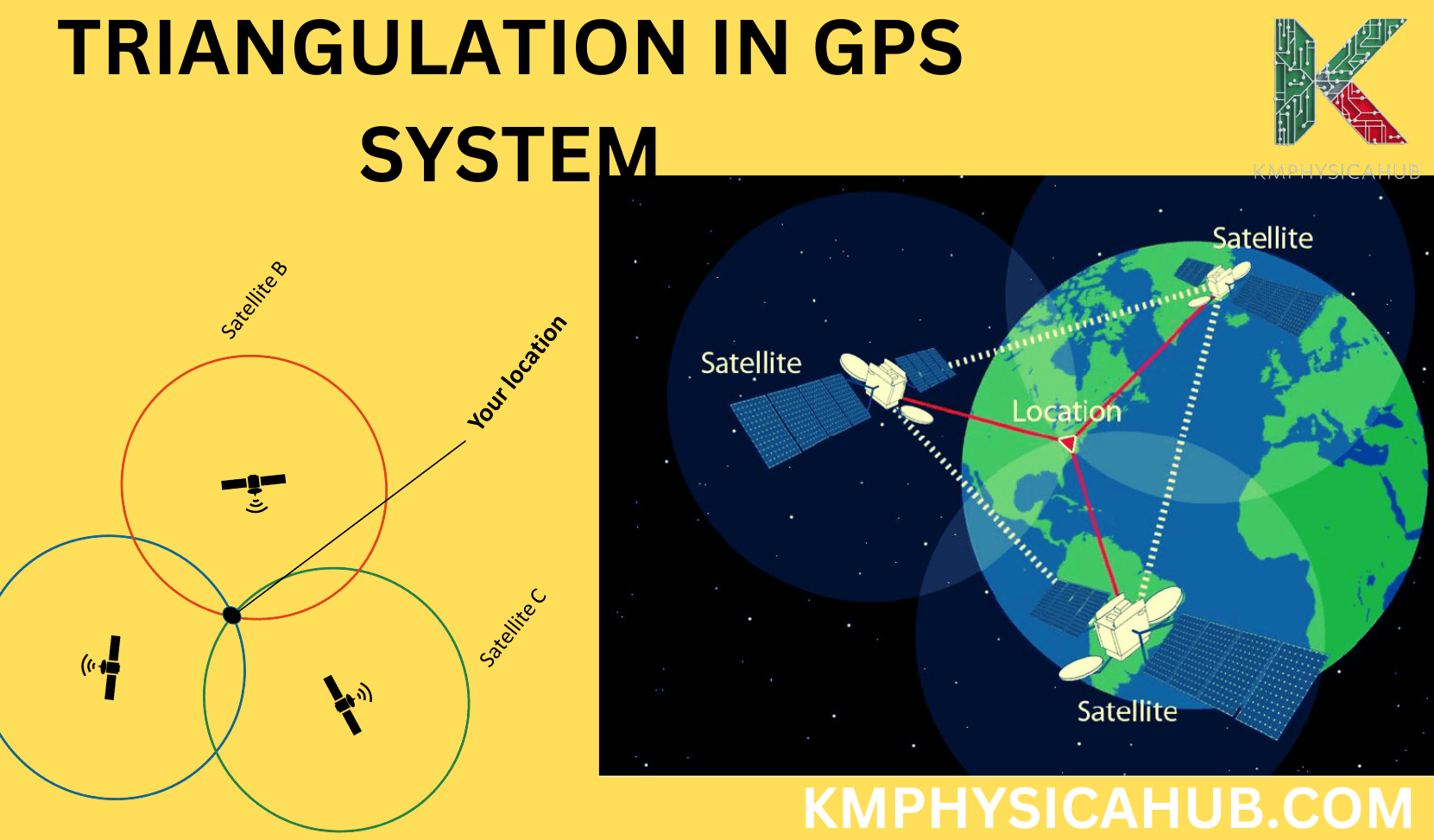
Navigational tools, which include the GPS receivers in our mobile phones or car GPS systems, capture these satellite signals. Using time difference of signals, the device calculates the distance between itself and each of the satellites. Think of it like this: if one has the velocity of sound and time of travel of the reflected sound waves, the distance to the reflecting surface can be determined.
Now, visualize that three different satellites are all transmitting their signals to your receiver. Using the distances to each satellite, the receiver then determines where it is located through a process known as triangulation. It is like finding the point of 3 circles intersectionality!
Relativity and Time Dilation
Einstein revolutionized the foundations of space and time with his theory of relativity and it is in light of this that understanding the issues of time on GPS becomes quite meaningful. Relativity proclaims that time is actually relative to the observer or the frame of reference one is in. What this means is that the time element may dilate or contract depending on the speed and gravitational influence which a person is exposed to.
Special Relativity and Time Dilation:
The special theory of relativity which was formulated and published in 1905 introduced such phenomenon as time dilation. It postulates that time is not universal and depends on the referential system that is being used for measurement.
Picture two clock faces; one that’s stationary and another that spins at a tremendous speed. In the frame of special relativity, time dilation means that the clock in motion will be slower than the one that is stationary. Time dilation is one of the effects which results from the Theory of Relativity which states that the speed of light in vacuum is the same for all observers.
General Relativity and Time Dilation:
The concept was further developed in theory of general relativity, which was presented in 1915 and expounded the effects of gravity. It predicts that time dilates in regions possessing higher gravitational fields than others.
Imagine that there are two clocks, the first one placed on the terrestrial surface and the second one placed in the vacuum of space in the absence of gravitational field. Since the clock on Earth has a greater grip from the gravity force as compared to that in the open space, the clock on the earth will be slower.
Influence of Relativity on GPS Clocks:
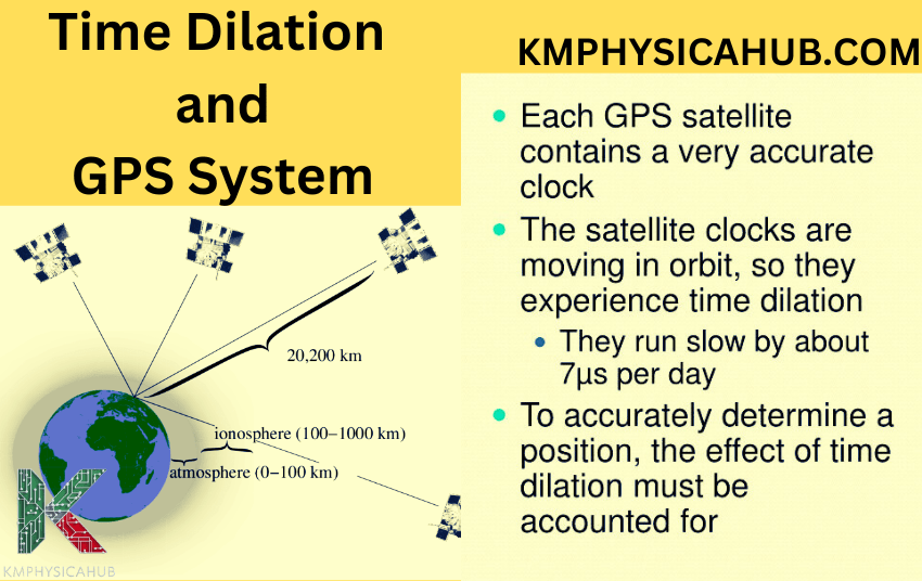
Now, let us discuss the atomic clocks that are stationed on GPS satellites. These clocks are traveling at high velocity compared to the earth clocks and also they are in a region of less gravity compared to clocks found on earth.
In the concept of relativity, these two aspects lead to the clock on satellites moving at a slower rate relative to those on the earth. Though it may seem a small difference, this variation is enough to impact GPS precision.
Impact of Neglecting Relativity
Imagine a world where GPS systems ignored relativistic effects. The consequences would be significant, leading to substantial errors in positioning.
For example, if relativistic corrections were not applied, a GPS receiver on Earth would experience a positioning error of about 10 kilometers per day! This error would grow rapidly over time, rendering GPS practically useless for navigation.
Other Factors Affecting Accuracy
While GPS is incredibly accurate, its precision can be influenced by various factors:
Atmospheric Conditions: Calibrated oscillations go through the atmosphere, and oscillations can be bent or slowed down, which leads to inaccuracies in measuring time.
Obstructions: Interference with GPS signals comes mainly from man-made structures such as building and mountains, or thick vegetation that may hinder GPS accuracy.
Number of Satellites: If a receiver can obtain the signals from as many satellites as possible, then its positioning calculation is more precise.
Receiver Sensitivity: The type and quality of the receiver antenna and its capacity to receive low signal power levels determine the results.
Types of GPS Navigation Systems
-
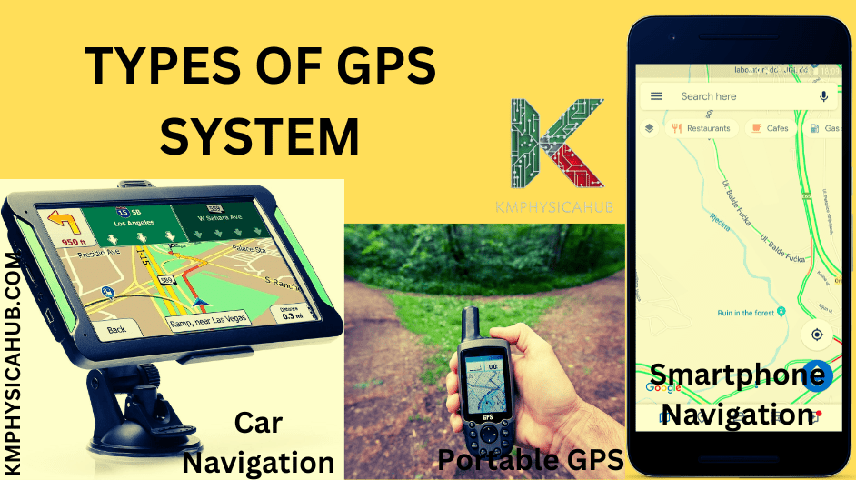
Car Navigation Systems
This is a system installed in cars that gives the driver real-time instructions on where to go and possibly the layout of the roads. They come in two main types:
Built-in Navigation Systems:
They are installed at the factory and sometimes come as a package with the vehicle’s entertainment system.
Aftermarket Navigation Systems:
These are standalone units that can be integrated into cars that have no integrated navigation systems. They provide flexibility especially in the formulation and can also be incorporated as the technological aspects are enhanced.
-
Portable GPS Devices
These are small and lightweight units meant for use in various outdoor activities such as hiking or backpacking or geocaching. They often include features like:
Topographic Maps:
They depict topography and presented in the form of contour maps.
Waypoints and Routes:
Function to set the places of interest and the option to set up routes.
Compass and Altimeter:
Give directional and elevation data if any.
-
Smartphone Navigation Apps
Smartphones today also have built-in GPS navigation and there are most numerous apps available for different features and conveniences. These apps take advantage of GPS in the smart phones and most of them have incorporation with other services such as traffic update, instant update and social networks.
Real-time Traffic Information:
These apps utilize data that has been collected from other people to explain current or real-time events regarding traffic and advise the users on how to avoid traffic congestion and hence take the shortest time to get to their destination.
Voice Guidance:
Navigation applications incorporate the use of the vocal instructions to help the user to learn directions without having to keep checking on the screen.
Offline Maps:
Most of the applications provide an option of downloading maps to be used in navigating while in an area that does not have network coverage.
Multimodal Navigation:
Navigation apps may offer routes for walking, biking, and taking public transportation to give other choices of travel.
Point-of-Interest Search:
People can look for a particular place such as hotel, restaurant, gas station or ATM and the application will lead them to it.
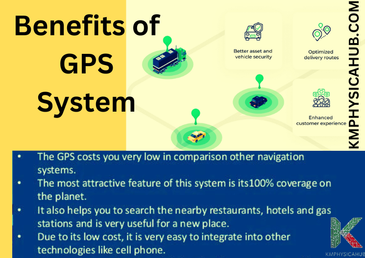
Benefits of GPS Navigation Systems
-
Convenience and Efficiency
Ideas such as GPS navigation systems have become the center stage of the development of how we travel.
Simplified Travel Planning: People are in a position to plan routes, look for directions, and even estimate the time it takes to get where they want to be.
Reduced Travel Time: This makes it easier for the drivers to avoid wasteful trips because the GPS system offers the shortest and best routes.
Enhanced Exploration: GPS makes it possible to navigate and introduce users to locations they may not be very familiar with.
-
Safety and Security
GPS plays a crucial role in enhancing road safety and providing emergency assistance:
Route Guidance: One of the significant benefits of GPS systems is that they give accurate and easily understood instructions so that the customer does not lost or goes the wrong way.
Emergency Assistance: During an emergency situation, such as an accident, GPS can promptly locate the user making rescue easier.
Vehicle Tracking: Vehicles can be tracked using GPS which offers security and aid in recovering of stolen cars.
-
Economic Advantages
GPS navigation systems can bring significant economic benefits:
Cost Savings: GPS also aid in efficiency of routes used by business thereby cutting down on fuel expenses and wear and tear on vehicles.
Increased Productivity: As implemented in logistics and delivery, GPS has proven to enhance the overall work effectiveness and bring down delivery time considerably.
Improved Resource Management: With GPS, one is able to locate their assets, plan on the best way to use the resources that they have and avoid wastage.
Challenges and Limitations of GPS
-
Signal Interference and Blockage
While GPS is highly reliable, its signals can be affected by various factors:
Signal Interference: Interference which usually comes from other electric devices or power lines can affect GPS signals.
Signal Blockage: Hindrances to GPS signals include buildings, mountains or even thick forest since they limit the GPS accessibility thereby obscuring the accurate positioning of the device.
Urban Canyons: Large buildings in urban areas complicate GPS signals hence, causing problems of inaccurate readings.
-
Privacy Concerns
The ability of GPS to track location raises concerns about privacy:
Tracking without Consent: GPS tracking can work effectively to track people’s movements even without their consent or knowledge.
Data Collection and Analysis: GPS information entered into the application could be accessed and sold to other parties with a high risk of violating privacy.
Surveillance and Control: GPS tracking has its concern in terms of monitoring or surveillance of individuals by the government.
Dependence on Technology
Our reliance on GPS technology poses certain risks:
System Failures: GPS systems like any other technologies can at times fail to perform their functions and this can cause some level of interruption in the services offered.
Cyberattacks: GPS systems can be hacked, which may lead to a variety of malfunctions or corruption of location information.
Dependence on Infrastructure: The operation of GPS depends on the network of satellites and a series of ground stations, which may be easily destroyed or disrupted.
Conclusion:
Navigation systems utilizing GPS data have entered the lives of people as one of the most vital innovations giving accurate location and time estimations. The system is based in satellites that orbit the globe and send signals to receivers through space to pinpoint the location by triangulation. It has been shown that GPS has changed the face of transportation, improved safety and security, and created economic value in the transport sector.
The future of GPS in physics seems to be even brighter with growing innovation and incorporation of GPS with other systems. GPS will remain at the forefront and be fundamental to the evolution of transportation, smart cities, and the IoT.
People Also Ask
Q1: What are some common applications of GPS?
A:
- Car navigation
- Smartphone navigation apps
- Mapping
- Emergency response
- Logistics
- Asset tracking.
Q2: Which factors affect GPS accuracy?
A:
- Atmospheric conditions
- Obstructions (buildings, mountains)
- Number of satellites available
- Receiver sensitivity.
Q3: How does time dilation affect GPS?
A: Clocks on GPS satellites are slightly faster due to the relativity, and this is the reason why correction factors are needed to make GPS accurate. This time difference should be addressed during GPS calculation to facilitate accurate positioning.
Q5: How do GPS systems account for time dilation?
A: Real-time information from the satellites is corrected by GPS systems using actual relativistic velocities of the satellites and their altitudes.
Q6: What would happen if GPS systems ignored relativity?
A: If relativistic effects were not taken into consideration, then positioning would be highly inaccurate and GPS navigation would not be usable.